Nepal must fix its borders using GPS technology By Khagendra Thapa
 Nepal is the oldest country in South Asia. Its boundary with the British India (when Britain ruled India) was demarcated back in 1816 when the Sugauli Treaty was signed between Nepal and Britain after a two -year long war between the two countries. In the Sugauli Treaty, Nepal signed with the British, Nepal lost over one third of its territory including Sikkim and Darjeeling in the East and Dehradun, Nainital, Ranikhet, Kumaon and Kangra in the West. Nevertheless, Nepal's boundary was demarcated in the south, east and west with the British using over one thousand boundary pillars. These boundary markers were numbered. Even numbered pillars were maintained by Nepal and odd numbered ones were maintained by the British. Both countries did so every year. Boundary maintenance was abandoned by both countries after the British left India and the autocratic Rana Rulers were overthrown in Nepal.
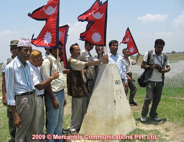
India has encroached Nepalese territory in numerous areas. However, the encroachment by India in the Kalapani-Limpiyadhura area with 372 sq km (37,800 hectares) is the largest chunk of Nepalese territory. The encroachment was initiated immediately after the China-India border war of November 1962. |
The British conducted the Survey of India starting from 1880. The survey itself was initiated by the British Surveyor General George Everest. He started the Survey Work from South India and using a series of triangles expanded all the way to northern India. Sir George Everest passed away before the survey work was completed. The survey of the boundary between Nepal and the British India was completed in 1926-27 which resulted in the mapping of the actual demarcation of Nepal-India boundary with 10yard no man's land on either side of the land boundary. Incidentally, when the Himalayan peaks were observed using theodolites (an angle measuring device) from India, it was found that Sagarmatha (Mt. Everest) was the highest mountain in the world. It was named Mt. Everest by the British in honor of their dedicated Surveyor General Sir George Everest because local name of the mountain could not be established since the Rana rulers would not allow the British surveyors entry into Nepal. Nepal's border with India is over 1,808 kilometers and disputes exist in at least 54 different places. Boundary markers at numerous of points have disappeared. In addition, the 10-yard wide strip of no man's land between the two countries is getting blurred (often times occupied by the Indians) day by day.
According to the reports prepared by Buddhi Narayan Shrestha an well-known border expert and former Surveyor General of Nepal, India has encroached about 59,970 hectares of Nepali territory at 54 points in 21 districts adjoining India in the East, West and South.
As stated above, India has encroached Nepalese territory in numerous areas. However, the encroachment by India in the Kalapani-Limpiyadhura area with 372 sq km (37,800 hectares) is the largest chunk of Nepalese territory. The encroachment was initiated immediately after the China-India border war of November 1962. After facing the humiliating defeat at the hands of the Chinese Red Army, the Indian army set up a camp inside Nepal's territory of Kalapani to keep an eye on Chinese activities. Having occupied it for many years, India now claims that the area belongs to India.
The Sugauli treaty states without ambiguity that the River Mahakali is the borderline of Nepal-India in the West. The main issue of disagreement is the determination of the origin of the river Mahakali. Mr Shrestha states, "The maps of 1850 and 1856 prepared by the Survey of India with the participation of Nepalese authority clearly states that the river originates from Limpiyadhura, 16 km northwest of Kalapani, which proves that Kalapani belongs to Nepal." However, the Indian Government refuses to accept those maps as proof. The Indian side states that the map prepared by them in 1875 should be considered as proof and not those of 1850 and 1856. The Indian side claim of 1875 maps being more scientific does not hold any credibility because between 1850 and 1875 there had been no changes either in the methods or the instrumentation of surveying. Moreover, the map did not have Nepal's certification. According to the map, the river Mahakali's origin is wrongly located at Lepulek and not its correct origin located at Limpiyadhura.
Rivers are used as boundary markers between Nepal and India for 595 Km of the border. Mechi in the East, Mahakali in the West and Narayani in the Susta area are used as boundary markers. Rivers are not very reliable as boundary markers because they tend to change course especially when they pass through plain lands such as in the case of Narayani river. The problem is further complicated because of the lack of old maps and documents.
The Tribeni-Susta situated on the East of Narayani River in the mid-southern part of Nawalparasi district of Nepal has turned into the most tense area owing to encroachment.
Within the last few years, over 1000 Indian villagers backed by Indian Border Police Force (Seema Sashastra Bal) SSB had forcibly entered Nepalese territory in Susta. They completely destroyed the sugarcane in about 10 hectares of land and also manhandled men and women. According to locals of Susta, such incidents are rampant in the area. Sometimes, they send Bihari miscreants to chase away Nepalese from their homes while sometime the Indian police cross the border and manhandle Nepalese on the pretext that they are searching for Indian gangsters.
Nepalese farmers initiated the "Save Susta Campaign" to safeguard Nepalese territory but how long can they stop the Indian side is the question. They say they appealed to Nepalese authorities several times to take necessary action but the authorities are turning a deaf ear to them.
Experts say the changing course of the Narayani River is the main reason behind the dispute. Over the decades, the Narayani River has been changing its course toward the Nepalese side in the west, and the Indians have been trying to capture Nepalese territory. India has so far grabbed about 13,500 hectares of Nepalese land because of the changing course of the Narayani River.
Extensive border mapping was done with the help of the Canadian government in 1985 and in 1992. Another mapping was performed with the assistance of the Japanese International Cooperation Agency (JICA). In both cases, the maps show the whole Susta area in Nepal's territory.
Because of the incompetent Nepalese Team's wrong decision of accepting thePersian Map as the basis of demarcation, a total area of 1630 hectares of Nepalese territory has fallen on the Indian side. |
The other disputed boundary between Nepal and India is in Mechi in the East. According to Vidya Bir Singh Kansakar, (Professor, Central Department of Geography, Tribhuvan University, Kathmandu) India does not accept the Masonry Pillars popularly known as Junge Pillars as the main boundary pillars and has thus sparked the Mechi Border dispute. The map published in January 1818, right after the Sugauli Treaty, shows the Junge Pillars as the main boundary pillars in Mechi between British India and Nepal. Moreover, British themselves had erected these pillars as monuments of the Nepal-British India border. Unfortunately, the Nepal-India Joint Technical Border Committee adopted the Persian Map (Urdu script) of 1874 as the reference material, which was provided by the Indian side. Because of the incompetent Nepalese Team's wrong decision of accepting the Persian Map as the basis of demarcation, a total area of 1630 hectares of Nepalese territory has fallen on the Indian side.
The Legislature-Parliament's international relations and human rights committee said that in the course of its on-site visit in south Nepal, Nepali territory was encroached by Indian side, Nepali state-run newspaper The Rising Nepal reported.
According to the paper, of the total of 685 border pillars in the Bara district, some 80 km south of Kathmandu, 264 were lost.
The information was based on the facts found from the on-site visit on by the committee led by Constituent Assembly (CA) member Nabindra Raj Joshi.
The parliamentary team inspected pillar number 381, 382, 383 and 384 of Martihawa and the encroachment was found in Das Gaja area from both Nepali and Indian sides, said team coordinator Joshi.
He added it was found during the inspection that the Indian side was attempting to capture land in Chhitkaiya of Bara district.
Another newspaper The Kathmandu Post also reported, "It was found that in Chhitkaiya, where Pasaha River used to separate Nepal and India, the Indian side had unilaterally established a pillar (No. 342/11) that falls about a km inside Nepali territory, thus encroaching about 14 hectares of land."
According to the various papers published in Nepal, about 2000 Nepalese people inhabiting the border regions of Dang have left their homes. They had to walk for two days and are now living in shelters in a forested areas in the district. They claim that they were driven out by the Indian border security force-- the Seema Surakshya Bal (SSB). It appears that the Indian side has over the past few years shifted the border pillars 35 meters into Nepalese territory, and that the SSB has acted in a manner most vicious towards Nepalese residing in the area. SSB has set their houses on fire and even kidnapped and raped women.
According to a report published in Kathmandu Post, separate delegations of Nepal's Constituent Assembly and Parliament have concluded that Nepalese territory was encroached by India in Dang district.
According to a nepalnews.com report, Amik Sherchan, chairman of the Committee for Protection of National Interest, was one of those making the claim.
Similarly, Padma Lal Biswakarma, the chairman of the International Relations and Human Rights Committee, who was the head of the parliamentary delegation, also confirmed at a press conference in Dang that Indian SSB has encroached and occupied Nepalese land. Indian government and some Nepalese officials including pro-Indian Foreign Minister Sujata Koirala have denied any border encroachment.
Nepal's Border with China
The demarcation of Nepal-China boundary was made through a topographical survey of 1956-58, which covered entire Nepal. The survey was conducted by the Survey of India. However, this survey could not properly delineate the boundary between Nepal and China because of the lack of proper and sophisticated instruments needed to survey high altitude rugged terrain.
According to Vidya Bir Singh Kansakar, (Professor, Central Department of Geography, Tribhuvan University, Kathmandu), an examination of the maps of 1961 and 1982 shows a major change in Humla and Mustang. The 1982 boundary maps were prepared through ground survey and were supported by aerial survey and satellite imageries. As a result of Nepal-China boundary agreement in 1982, Nepal gained a total of 1,876 sq. km of area.
Along the entire Nepal China boundary, there are only 79 boundary pillars. Under the protocol signed and exchanged between Nepal and China on January 20, 1963, the contracting parties agreed to maintain and adopt necessary measures to prevent the removal, damage or destruction of boundary pillars as far as possible. They also agreed to prevent the boundary rivers from changing their course and to make a joint inspection of the entire boundary every five years. Accordingly, in 1979 a new agreement was signed between the two countries after detailed mapping and demarcation of the boundary.
Fix the border using GPS
In order to avoid the border disputes due to changing course of the river or due to the loss of border pillars, Nepal should in coordination with the neighbors use Global Positioning System (GPS) coordinates to locate and position the boundary markers. These coordinates are based on the World Geodetic System 84 (WGS84) geodetic datum. GPS provides unique coordinates for each point on the surface of the earth with centimeter accuracy. Even if a pillar is missing, it can be recovered with high accuracy. This will solve the border disputes arising from the loss or damaged markers or the changing course of rivers.
(Dr. Thapa is a professor at Ferris State University, Big Rapids, Michigan, USA. He has been teaching Geodesy and GPS for over three decades. His email: Khagendra_Thapa@ferris.edu.)
(Editor’s Note: Nepalis, wherever they live, as well as friends of Nepal around the globe are requested to contribute their views/opinions/recollections etc. on issues concerning present day Nepal to the Guest Column of Nepalnews. Length of the article should not be more than 1,000 words and may be edited for the purpose of clarity and space. Relevant photos as well as photo of the author may also be sent along with the article. Please send your write-ups to editors@mos.com.np)


.png)